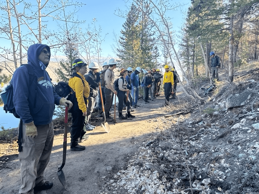
On October 25, GARNA helped organize a second work day in the Interlaken Fire zone. Our Blue Elements Americorp, Rose, worked with the Arkansas River Watershed Collaborative, Colorado Springs Utilities and the US Forest Service to connect with volunteers to continue the post fire recovery work from July’s fire. Alan Robinson, one of the leads for Friends of Fourmile and longtime GARNA member, attended both work days and gave a great report on what has been accomplished.
—
I didn’t put in as much physical effort as on the first workday but spent more time with the watershed specialist from Colorado Springs Utilities to learn more about best practices on minimizing damage from flash flooding down steep burned-over slopes.
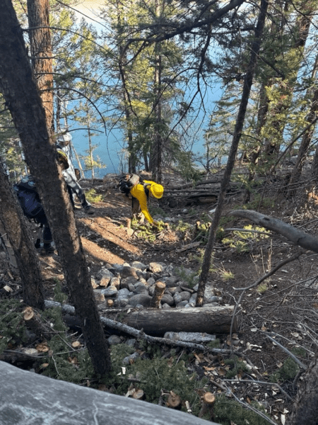
The USFS crews have made significant steps in slowing potential fast flows down two major gulches before the slopes get more gentle as you approach the Interlaken Historic Site. There’s one more before the historic site – Flume Creek – they are going to work on this season if the snow doesn’t close them down, or in the early spring. Most potential flooding is expected during next season’s monsoonal rains (July and August 2025) but there may also be some as this winter’s snowpack melts off in the early/late spring. My own sense is that although their work on the gulches may be quite helpful, the additional problem runoff may come from in between the gulches, where sheet flow down the disturbed and loosened soils can rapidly coalesce into new mini channels and sweep a lot of sediment and debris down across the trail and into the reservoir (image below). The FS sawyers are hoping to minimize this by felling dead timber across the slopes to slow the runoff.
USFS Leadville District Ranger Pat Mercer was in attendance, and I decided to tag along with him and the Colorado Springs watershed specialist Mark Shea as they proceeded up the trail to Interlaken to discuss post burn strategies. I’ve gotten to know Pat during his five years as District Ranger, especially because the GARNA Stage & Rail project involves USFS lands in Lake County, but also because all of the Leadville District is included in the Camping Management Plan the FS is “still close” to approving. I always include Leadville/Pat in distribution of the annual FoF Memorial Day Visitor Use Survey report. Yesterday he brought up and we discussed conclusions in our 16th report (for 2024) and he genuinely complemented the FoF for our long dedication to doing this work. He, like the other agency people, recognize this as the most comprehensive and useful visitor use data series anyone locally has in helping evaluate visitor use increases and impacts. So thanks, FoFers, for those hundreds of survey hours you’ve contributed!
Some context about stresses the Leadville District is facing due to hiring restraints, which mirror ones we know about on the Salida District. The Leadville District also cannot hire any non-wildfire related seasonal staff for 2025, so that means no recreation seasonal staff – and the Leadville District doesn’t have any of the potential workarounds the FS Salida District may have due to Chaffee County’s Common Ground funding . That’s on top of not being able to fill positions of two very important long-serving permanent staff who retired this past winter: Steve Sunday, Wilderness Back Country Ranger for two decades, and principle contact for GARNA’s Upper Arkansas Wilderness Volunteers, and Loretta McEllhiney, liaison with the Colorado Fourteeners Initiative. In addition to meaning there may be much less 2025 work in these two sectors, it means a tremendous loss of institutional memory for the District, which a District Ranger really depends on. Volunteer projects like this one will be crucial going forward in both Leadville and Salida to keep our public lands maintained.

Per the image, you can see that in this section the Interlaken Trail is wide and flat. That’s because in just few places the trail follows what was in about 1908 a motorable road from Granite along the south shore of what was then a smaller, lower-level Twin Lakes to reach the Interlaken Hotel and to even on to the Twin Lakes community. This was an alternative route selected by the transcontinental driving route Pikes Peak Ocean To Ocean Highway promoters as it proceeded from Buena Vista to Leadville. When the Twin Lakes dam was constructed (or raised), the reservoir level rose considerably and most of the old PPOO route got submerged.
Although I didn’t have to time explore I did confirm the fire did not extend into the historic site, although it did reach as close as a couple of hundred yards to the south side. There are still some sections of the Colorado Trail that are closed and will remain so for considerable time because of fire damage and potential hazards.


GARNA works with communities of the upper Arkansas River valley to foster the stewardship of the region’s natural environment and the resilience of our communities.